COSPAS-SARSAT System
COSPAS-SARSAT is a Search and Rescue (SAR) system that uses polar and equatorial orbit satellites to provide its users with distress alerts and related position information in the air, at sea, and on land.
In 1979, Canada, France, the United States, and the former Soviet Union established the International COSPAS-SARSAT Program to detect distress calls and assist people in danger during emergencies. According to The Washington Post's September 30, 1982 issue, the first rescue operation was carried out in 1982.
Official logo of the COSPAS-SARSAT Program
As of today, 45 countries are part of the COSPAS-SARSAT Program. The full list of participants can be viewed here. Additionally, the International Telecommunication Union (ITU), International Civil Aviation Organization (ICAO), and International Maritime Organization (IMO) work in close cooperation with COSPAS-SARSAT.
What is COSPAS-SARSAT?
In Russian, COSPAS stands for "Cosmicheskaya Sistyema Poiska Avariynich Sudov," meaning "Space System for Search of Vessels in Distress," while SARSAT stands for "Search and Rescue Satellite-Aided Tracking."
The COSPAS-SARSAT system aims to provide assistance to the area by reducing delays in distress alerts given to search and rescue services and the time required to locate the incident site. Thus, it directly impacts the survival probability of people in distress in the air, at sea, or on land. The COSPAS-SARSAT system consists of the following components:
-
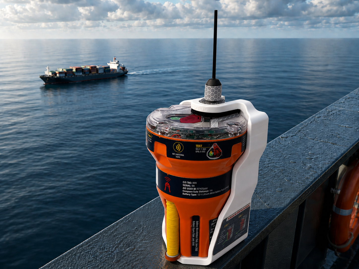
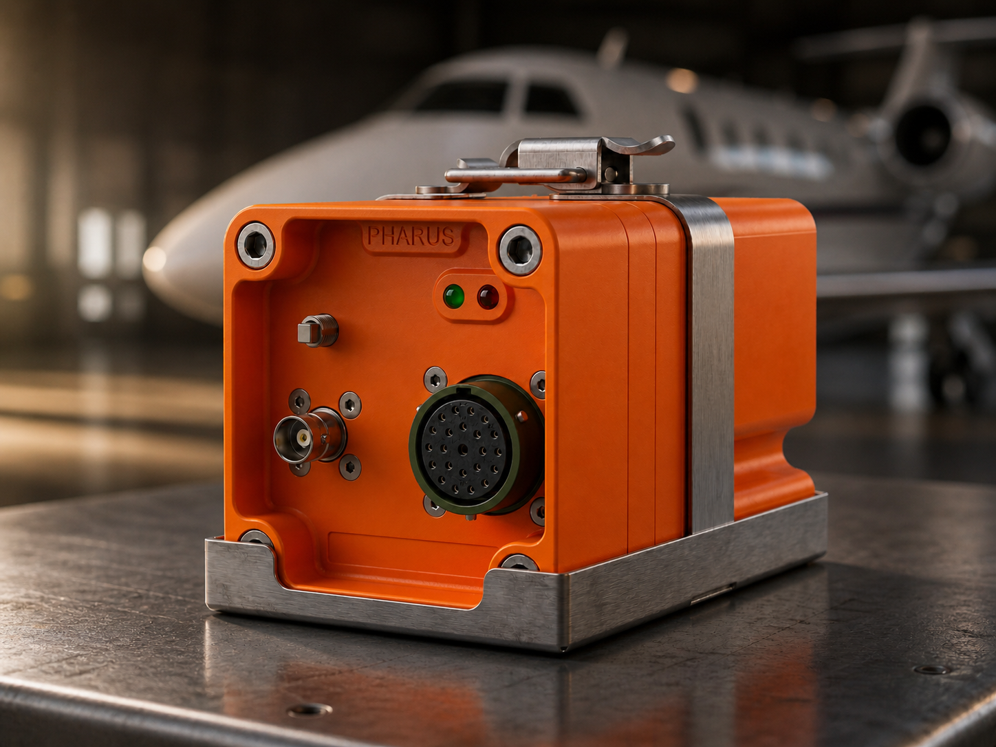
Distress beacons that transmit distress signals
- Emergency Locator Transmitter (ELT) for aircraft
- Emergency Position Indicating Radio Beacon (EPIRB) for maritime vessels
- Personal Locator Beacons (PLB) for personal use
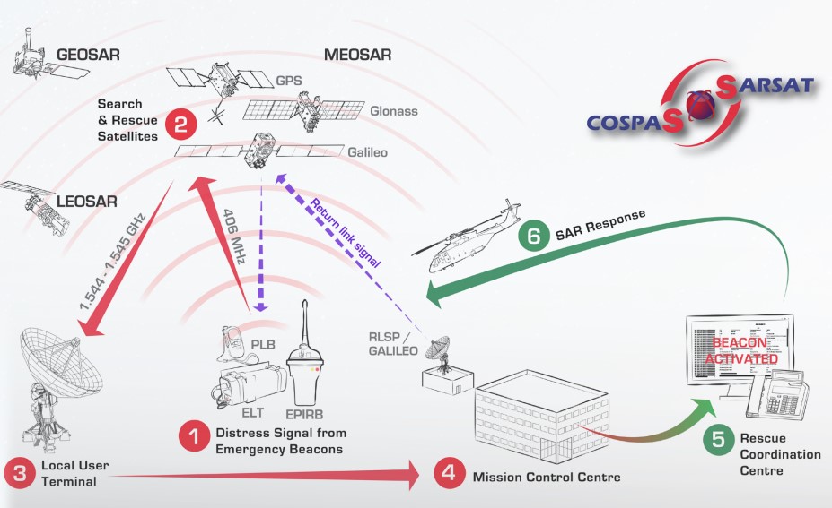
- Satellites that receive distress signals transmitted by beacons
- Low-altitude Earth orbit (LEO) satellites
- Geostationary Earth orbit (GEO) satellites
-
Local Users Terminals (LUTs) that receive, process, and generate emergency alerts from satellite signals
- Mission Control Centers (MCCs) that receive emergency alerts and relay them to appropriate organizations or other MCCs
How Does COSPAS-SARSAT Work?
When an emergency occurs such as maritime accidents, aircraft crashes, or lost mountaineers, distress beacons (ELT, EPIRB, PLB) transmit distress signals to satellites on the 406 MHz frequency, which is the international search and rescue frequency. These signals, which can be detected by LEO and GEO satellites scanning the Earth's surface, are relayed to Local Users Terminals (LUTs) located at various points around the world as receiving stations. Location and, where possible, identity information is obtained from the processed information. The processed information is sent to Mission Control Centers (MCCs) where search and rescue activities are planned and coordinated. Depending on the received information such as aircraft or ship accident or incident site, the MCC unit sends this information and message to the responsible Rescue Coordination Center (RCC) or SAR Points of Contact (SPOCs). In this way, incident response can occur.
It should not be overlooked that only signals from transmitters (ELT, EPIRB, PLB) operating at 406 MHz are received and located by the COSPAS-SARSAT system. Additionally, signals sent at 121.5 MHz frequency have not been supported since February 1, 2009.
COSPAS-SARSAT in Numbers
According to the latest issue (No.46) of COSPAS-SARSAT System Data published in December 2020, as of today:
-
As of December 31, 2019, there are approximately 1,866,000 registered transmitters globally.
-
As of December 31, 2019, between January and December 2019, the COSPAS-SARSAT system assisted in the rescue of at least 2,774 people in 1,032 Search and Rescue (SAR) events.
-
212 of the mentioned SAR events occurred in the air and 411 people were rescued.
-
431 of the mentioned SAR events occurred at sea and 1,747 people were rescued. This was the highest number in both events and people rescued.
-
389 of the SAR events occurred on land and 616 people were rescued.
-
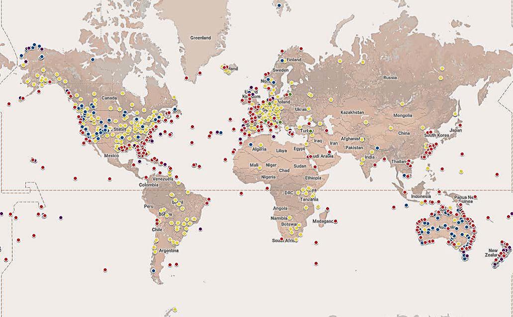
The geographic distribution of confirmed SAR events where the COSPAS-SARSAT system was used between January and December 2019 is shown in the figure. Yellow markers represent ELTs, red represent EPIRBs, blue represent PLBs used on land, green represent PLBs used in aviation, and pink represent PLBs used in maritime.
-
Between September 1982 and December 2019, the COSPAS-SARSAT system assisted in the rescue of at least 51,512 people in 15,563 events.
By Can Önal- [email protected]