
 ELT
ELT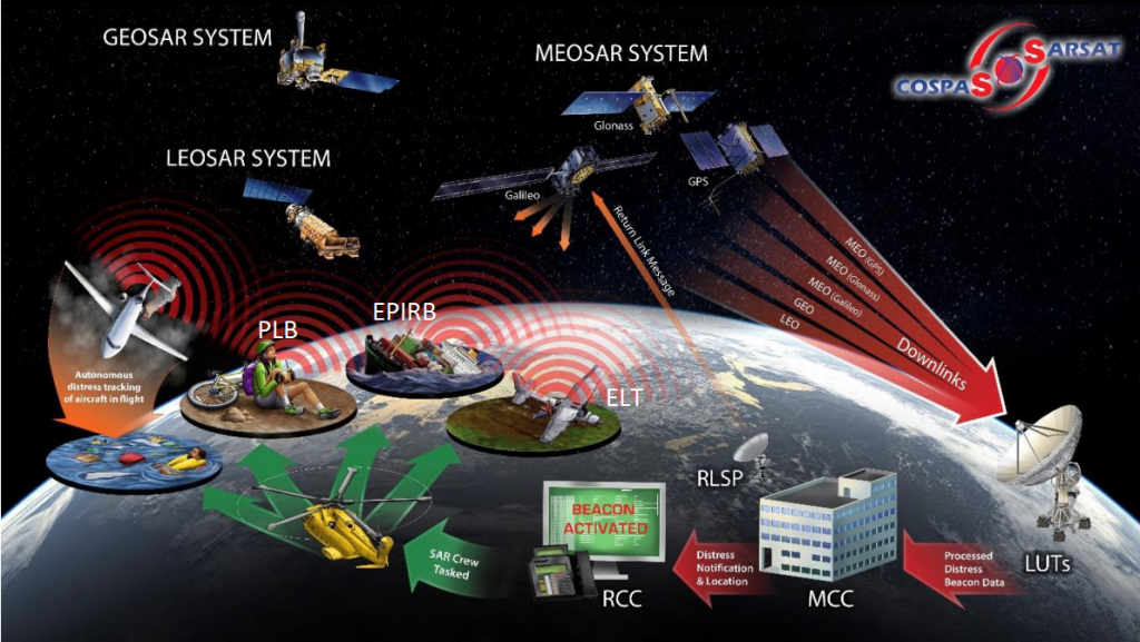
What is a distress beacon?
With the developing means of transportation, the world is getting smaller and smaller. Despite the enhancing technology, there is always the possibility of dangerous incidents because of external or internal factors. In the event of an emergency, such as an airplane disaster, a ship sinking, or a hiker going missing, the beacon is activated and begins transmitting a continuous radio signal that search and rescue(SAR) organizations use to locate the situation and provide help immediately.
Types of distress beacons
Distress beacons can be classified into three categories according to their usage:
- Personal Locator Beacons (PLB) for personal usage
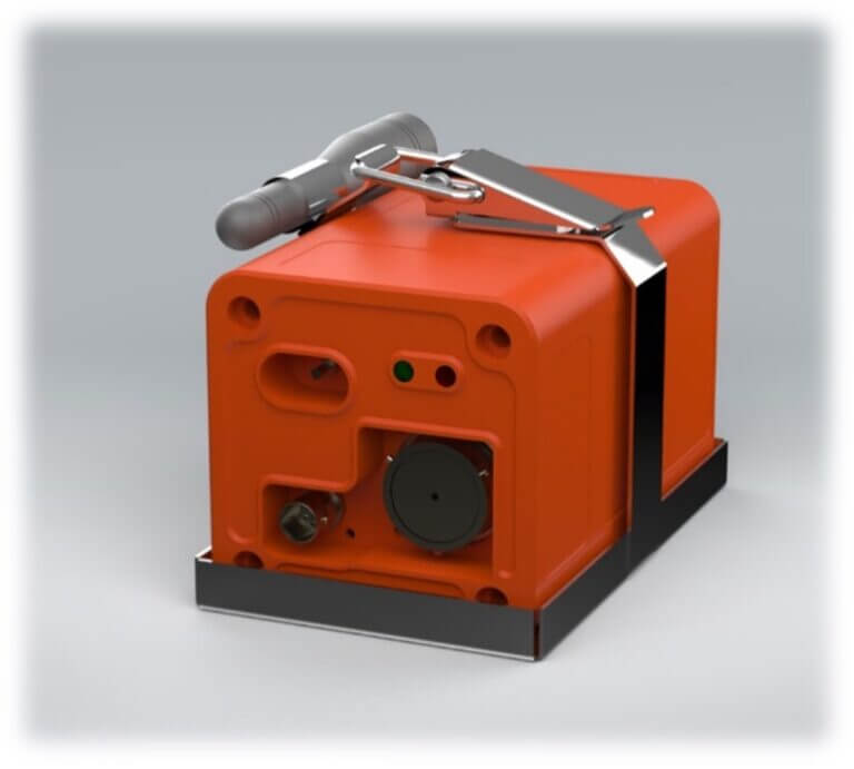
- Emergency Locator Transmitter (ELT) for aircrafts
- Emergency Position Indicating Radio Beacon (EPIRB) for sea vessels
 ELT
ELT
Emergency Locator Transmitter is a device used in Search and Rescue(SAR) services to provide position information about the current location of the aircraft in case it is exposed to an accident or serious incident. As of regulations, their presence in aircraft is mandatory. ELTs can be activated automatically or manually by the pilot. They broadcast on 121.5 or 406 MHz in order to provide the location via various satellites only in emergency situations. Nonetheless, on February 1st, 2009, the International COSPAS-SARSAT Program terminated satellite monitoring of 121.5 MHz*. They are required to transmit signals at least 24 hours up to 48 hours. EPIRBs or PLBs may be carried in place of an ELT in particular cases.
PLB
Personal Locator Beacons are the smallest beacons among other beacons and they are suitable for personal usages such as hikers, land explorers, workers operating in isolated locations, boat crews, and aircrew. PLBs are not mounted to a vessel or aircraft but belong to an individual. Although they can be used in a variety of places, their main usage is land-based. While activated, their battery can last 24 to 35 hours. Whereas in standby mode, it can last up to 5 years. Nevertheless, after activating and using the device, the battery must be replaced. Different from other beacons, they can only be turned on manually and only function on 406 MHz.
EPIRB
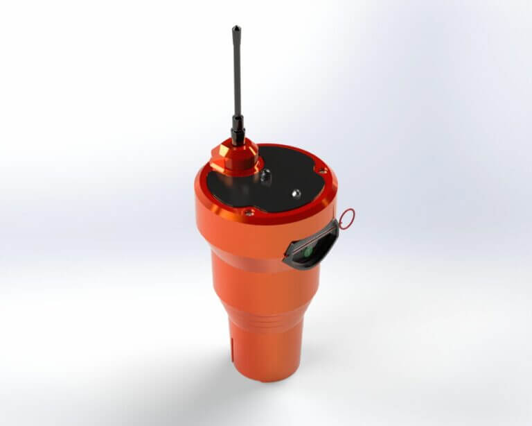
Emergency Position Indicating Radio Beacon is a device that is activated manually or automatically(when it falls into the water) when an emergency is encountered that requires the abandonment of the ship(sinking, fire, etc.). It floats in the sea, gives an illuminated visual warning (flash), and broadcasts emergency signals on 406MHz and 121.5MHz frequencies*, allowing it to be detected by satellite and land stations. It is critical that it is installed outside of the vessel’s cabin, where it may “float free” of the sinking vessel. They must be registered to the vessel. EPIRBs can transmit signals for at least 48 hours and their battery life is usually up to 10 years.
*Satellites no longer detect 121.5 MHz distress beacons. Although they can be still licansed, it is highly disadvantageous to rely on them. Frequencies of 121.5 MHz and 243 MHz will continue to be listened to on ground stations.

Graphical representation of 406 MHz Distress Beacons that have been operational during the first 30 years of the COSPAS-SARSAT System
How distress beacons work?
Every 50 seconds, 406 MHz distress beacons emit a half-second burst of data. The beacon message is sent by the COSPAS-SARSAT satellites(LEO and GEO satellites) to COSPAS-SARSAT earth receiving stations known as Local User Terminals (LUTs), which automatically evaluate the beacon message and determine the distress signal’s geographical position. Each message sent by a 406 MHz beacon must have a unique identifier for the beacon. The protocol flag, protocol code, country code, and other identifying data make up the whole beacon identification code, which is contained in the first protected data field of the 406 MHz transmission. Depending on the coding protocol needed by the relevant administration, identification data can be delivered in a variety of alphanumeric forms. It is encoded in binary format with the country code and other information in the beacon message. Also, it is important that the beacon signal must allow for the calculation of a position independent of the message’s content.
Only beacons that meet the COSPAS-SARSAT specification and type approval standards should be used to guarantee those performance requirements are satisfied and that the quality of alert and location data transmitted to search and rescue (SAR) services is maintained. Thereafter, the processed data is delivered to Mission Control Centers (MCCs), which plan and coordinate search and rescue operations.
By Can Önal- [email protected]


 Mor Teknoloji


